
Why is Google Earth showing a plane 'at the bottom of a lake'?
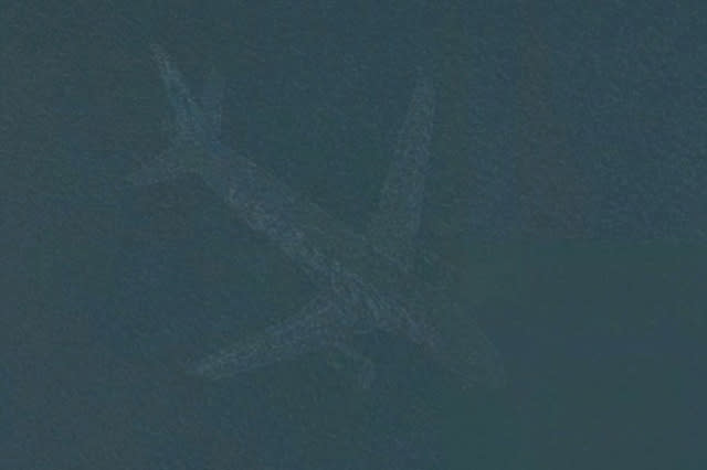
A plane has been spotted at the bottom of a lake in Minneapolis, USA on Google Earth - but it's not what it seems according to staff at Google.
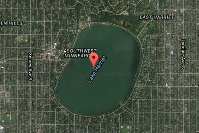
Users of the map service who zoomed into Lake Harriet saw an unmistakable twin-engine aircraft which appeared submerged in the water.
SEE ALSO: Google Street View snaps polar bears in Canada
SEE ALSO: Inside British Airways' business class-only flight without buying a ticket
Officials who oversee Minneapolis parks had no information about a plane in the lake but staff at Google offered an explanation.
Speaking to The Minneapolis Star-Tribune, spokeswoman Susan Cadrecha said: "In short: each satellite image you see on the map is actually a compilation of several images.
Cadrecha, who consulted with Google technicians, added: "Fast-moving objects like planes often show up in only one of the many images we use for a given area. When this happens, faint remnants of the fast-moving object can sometimes be seen."
A similar image of a plane appeared in nearby Lake Nokomis.
The Star-Tribune reported that more than 400,000 planes take off and land at the nearby Minneapolis-St. Paul International Airport each year.


