
Will there be another UK heatwave this summer?
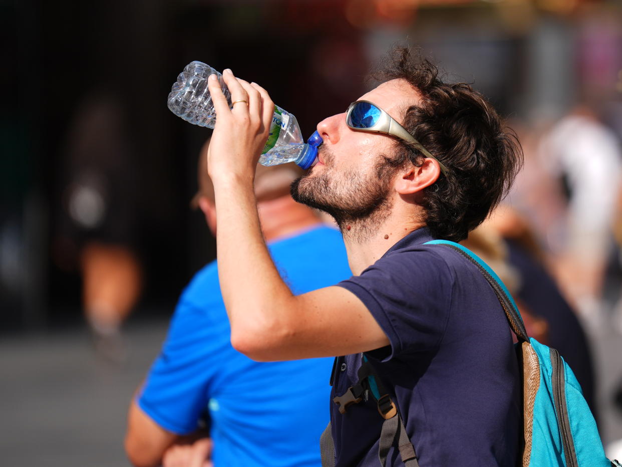
Parts of the UK are set to enjoy "very warm sunny spells" on Wednesday, the Met Office has said.
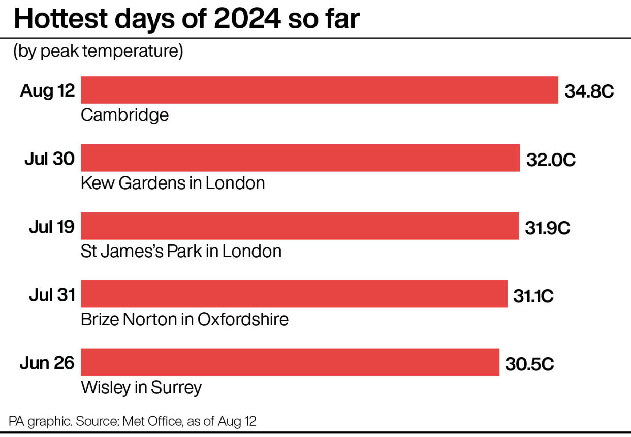
It comes after temperatures stabilised in the two weeks since the UK saw the hottest day of the year - at 34.8C - so far.
But with sunny weather back on the cards this week, is there time for a heatwave in what is left of the summer?
At the moment, it seems unlikely.
The Met Office's current five-day forecast, covering Thursday to Saturday, only promises "lighter winds than of late with temperatures near or just above average for the time of year".
In its forecast covering 31 August to 9 September, the agency is predicting "a trend towards very warm or fairly hot conditions, especially in southern areas around the turn of the month, with a chance of a few showers or thunderstorms as a result".
So, while more warm weather is possible, it's likely to fall short of a heatwave.
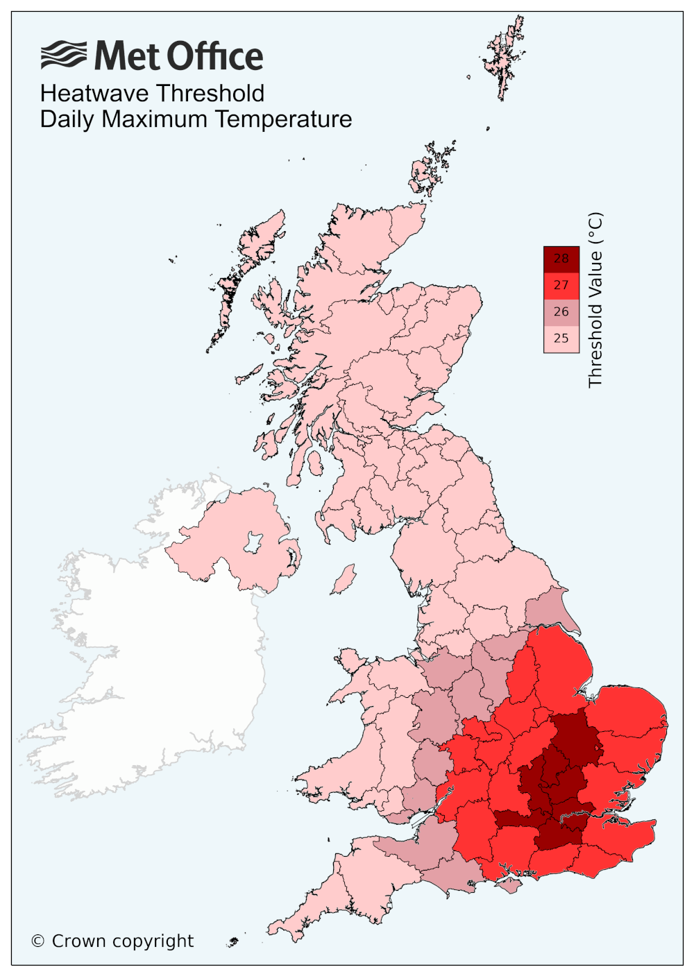
What is a heatwave?
A heatwave is defined by the Met Office as "when a location records a period of at least three consecutive days with daily maximum temperatures meeting or exceeding the heatwave temperature threshold".
This threshold varies according to the region, which can be seen on the map below.
Here, Yahoo News UK breaks down what the weather will be like for each region of the UK over the coming days, according to the Met Office's short-term forecasts.
London and the South East
Wednesday
Variable cloud amounts on Wednesday morning and remaining mostly dry. A lot of bright weather with sunny spells. Chance of a shower later, mainly in west, perhaps rather heavy. Winds light. Maximum temperature 27C.
Thursday to Saturday
Mostly fine to end the week with clear or sunny spells. Temperatures near or slightly above normal. Light winds but a noticeable wind across Kent with cooler conditions developing.
South-West
Wednesday
A band of cloud and patchy rain moving eastwards through the morning with sunnier spells either side. Feeling warmer in the sunshine further east. Maximum temperature 24C.
Thursday to Saturday
Brighter with a few showers on Thursday. Drier on Friday and Saturday as higher pressure builds, though a few showers possible in the far west. Temperatures nearer average.
Midlands
Wednesday
East Midlands: Variable cloud amounts for Wednesday morning and probably dry. Brightening with sunny spells. Chance of a shower later, perhaps rather heavy. Winds remaining light. Maximum temperature 27C.
West Midlands: Rather cloudy at times, with patchy rain clearing eastwards through the day mixed with sunnier intervals. Feeling warm in the sunshine. Maximum temperature 24C.
Thursday to Saturday
East Midlands: Turning increasingly fine to end the week with clear or sunny spells and light winds. Temperatures mostly near normal. Cooler near coasts by Saturday, with an onshore breeze.
West Midlands: Drier and brighter through the period as higher pressure builds into the weekend. Lighter winds than of late with temperatures near to average.
North-East
Wednesday
Starting mostly cloudy Wednesday morning with some rain. Brighter with sunny spells by afternoon with chance of a shower, perhaps heavy. A fine evening is likely. Maximum temperature 22C.
Thursday to Saturday
Turning increasingly fine to end the week with clear or sunny spells and light winds. Temperatures mostly near normal.
North-West
Wednesday
Rather cloudy to start with cloud thick enough for a few showers. Some brighter spells may develop into the afternoon with showers fading. Lighter winds than of late. Maximum temperature 20C.
Thursday to Saturday
Largely drier and brighter through the period as higher pressure builds, though still with a few showers around at first. Generally lighter winds with temperatures near to average.
Scotland
Wednesday
Rather cloudy with scattered showers, some of which may turn into longer spells of rain and heavy at times. Best of the sunnier spells across eastern coasts Maximum temperature 20C.
Thursday to Saturday
Bright spells and showers on Thursday, some of these heavy. Mainly dry and settled on Friday and Saturday with lengthy periods of sunshine.

Northern Ireland
Wednesday
Rather cloudy morning with outbreaks of occasionally heavy rain. Sunny spells developing into the afternoon with a few scattered showers. Maximum temperature 19C.
Thursday to Saturday
Bright spells and scattered showers on Thursday. Mainly dry and settled on Friday and Saturday with lengthy periods of sunshine.
Wales
Wednesday
Rather cloudy to start with outbreaks of light rain and drizzle. Turning drier and brighter into the afternoon with sunnier spells developing. Maximum temperature 23C.
Thursday to Saturday
Drier and brighter through the period as higher pressure builds into the weekend. Lighter winds than of late with temperatures near to average.

