
‘Dangerously hot’ weather roasts US west as brutal summer continues
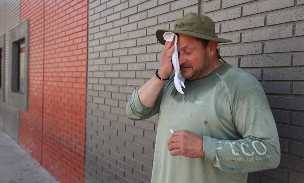
Searing temperatures are roasting the US west once again this week, as a brutal heatwave could bring some of the highest temperatures of the summer so far.
Excessive heat warnings were in effect across parts of southern California, Arizona and Nevada, affecting tens of millions of people. The harsh weather was predicted to peak beginning on Wednesday and lasting into the weekend.
The city of Los Angeles could see temperatures approaching 100F (37.7C), with locations further inland hitting nearly 110F (43.3C) or higher, according to a forecast from the National Weather Service (NWS).
“Dangerously hot conditions with peak temperatures of 95 to 110 possible, hottest Thursday and Friday. Warm overnight low temperatures will bring little relief from the heat,” the NWS warned in an advisory.
Desert cities such as Palm Springs were expected to see multiple days over 110F, while highs in Death Valley national park, which is experiencing its hottest summer on record, were expected to soar up to 118F (47.7C) on Friday. In Santa Barbara county, officials issued a health alert due to spiking inland temperatures.
Unusually high temperatures were also predicted across the Bay Area and Central valley. Even normally temperate San Francisco was predicted to be at least 13 degrees above average. It was so out of character for San Francisco that the National Weather Service issued a heat advisory.
Heat Advisory in effect NOW until 6 PM today for San Francisco, especially along the Bay Shore and the Mission District. #CAwx pic.twitter.com/qGJQBRxKWu
— NWS Bay Area 🌉 (@NWSBayArea) September 3, 2024
“We’re talking about a solid four days of heat,” the meteorologist Mike Wofford told the Los Angeles Times. “We’ve had three or four days of hot weather before but this one is hotter and longer than most of the other heat waves we’ve had.”
The heatwave will add to the pain of what has already been a devastating summer across the region.
Californians have just experienced their hottest July of all time, with the state’s average temperature for the month recorded at 81.7F (27.6C). Many cities have endured multiple days of temperatures greater than 100F (about 38C), and several cities broke temperature records during a remarkable July heatwave.
There has been little relief for residents in other states, particularly across the US south-west. Las Vegas, Nevada, also saw its hottest ever July, and broke an all-time daily temperature record when the city hit 120F (48.8C). Meanwhile in Phoenix, Arizona, the city marked its 100th consecutive day of temperatures over 100F on Monday, surpassing a streak set in the 1990s.
The baking heat primed the west for an explosive fire season, after a wet winter covered landscapes in grasses and vegetation that quickly dried out into readymade tinder.
The fire season is still in full swing and the September heatwave could make things even worse. Oregon has seen more fire this year than any other, with almost 1.5m acres (607,028 hectares) scorched by mid-August. The state is expected to see triple-digit temperatures this week and then thunderstorms, which authorities advise will bring “significant ignition potential”.
Dozens of wildfires continue to burn from Washington to Idaho to Arizona, while California has been battling its fourth largest wildfire in state history, the Park fire, since mid-July – although that fire is now nearly fully contained. A growing wildfire near the remote northern California mountain community of Sierra Brooks, near Lake Tahoe, forced hundreds of people to evacuate on Wednesday as the searing temperatures threatened to make fire conditions worse.
Acres burned
US wildfires are measured in terms of acres. While the size of a wildfire doesn’t necessarily correlate to its destructive impact, acreage provides a way to understand a fire’s footprint and how quickly it has grown.
There are 2.47 acres in a hectare, and 640 acres in a square mile, but this can be hard to visualise. Here are some easy comparisons: one acre equates to roughly the size of an American football field. London’s Heathrow airport is about 3,000 acres. Manhattan covers roughly 14,600 acres, while Chicago is roughly 150,000 acres, and Los Angeles is roughly 320,000 acres.
Megafire
A megafire is defined by the National Interagency Fire Center as a wildfire that has burned more than 100,000 acres (40,000 hectares).
Containment level
A wildfire’s containment level indicates how much progress firefighters have made in controlling the fire. Containment is achieved by creating perimeters the fire can’t move across. This is done through methods such as putting fire retardants on the ground, digging trenches, or removing brush and other flammable fuels.
Containment is measured in terms of the percentage of the fire that has been surrounded by these control lines. A wildfire with a low containment level, such as 0% or 5%, is essentially burning out of control. A fire with a high level of containment, such as 90%, isn’t necessarily extinguished but rather has a large protective perimeter and a rate of growth that is under control.
Evacuation orders and warnings
Evacuation warnings and orders are issued by officials when a wildfire is causing imminent danger to people’s life and property. According to the California office of emergency services, an evacuation warning means that it's a good idea to leave an area or get ready to leave soon. An evacuation order means that you should leave the area immediately.
Red flag warning
A red flag warning is a type of forecast issued by the National Weather Service that indicates when weather conditions are likely to spark or spread wildfires. These conditions typically include dryness, low humidity, high winds and heat.
Prescribed burn
A prescribed burn, or a controlled burn, is a fire that is intentionally set under carefully managed conditions in order to improve the health of a landscape. Prescribed burns are carried out by trained experts such as members of the US forest service and indigenous fire practitioners. Prescribed burns help remove flammable vegetation and reduce the risk of larger, more catastrophic blazes, among other benefits.
Prescribed burning was once a common tool among Native American tribes who used “good fire” to improve the land, but was limited for much of the last century by a US government approach based on fire suppression. In recent years, US land managers have returned to embracing the benefits of prescribed burns, and now conduct thousands across the country every year.
Recent weeks have brought some relief from the most extreme heat, but fire officials are nonetheless worried that the west will face significant fire potential into the fall.
“We’re about halfway through our season and it’s real busy and [we’re] getting the crew in that mental and physical mindset that we still have three months to go,” Dan Mallia, a firefighter who works with a special US Forest Service “hotshot” crew, told the Guardian last month. “We have just been doing back-to-back assignments. It’s been challenging.”
Scientists say the climate crisis caused by human activities is dialing up the thermostat around the world and increasing the odds of dangerous temperatures. That is because the driver of global warming – the release of greenhouse gases from the burning of fuels such as oil, gas and coal – continues all but unabated. Extreme weather events such as heatwaves, wildfires, intense storms and prolonged droughts will continue, according to researchers.
Further south, cooling centers were set up across Los Angeles county, where officials urged residents to check on neighbors who are elderly, unwell or otherwise vulnerable amid soaring temperatures. “Hot days aren’t just uncomfortable – they can be dangerous,” said the Los Angeles county health officer Muntu Davis.

