
Hurricane tracker: Latest paths and forecasts for Hone, Gilma and Hector as they churn in the Pacific
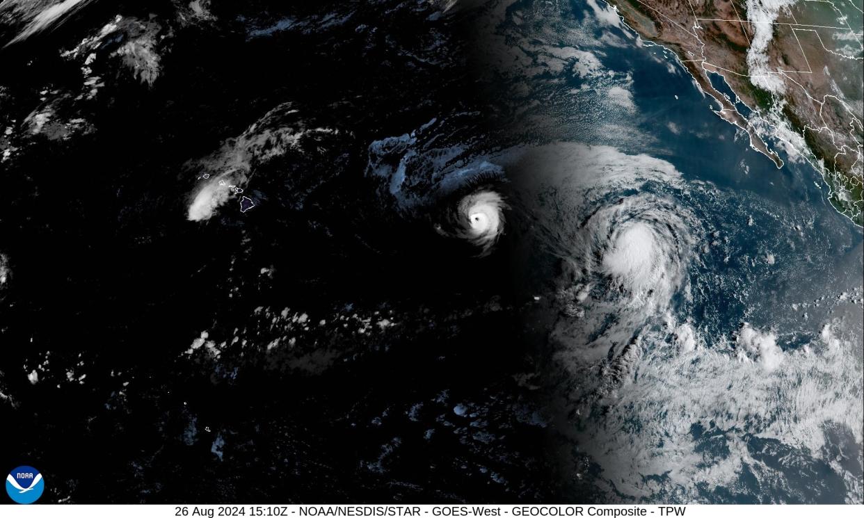
A cluster of storms is churning in the northern Pacific as of Monday morning: Hurricane Gilma and Tropical Storms Hone and Hector. Tropical Storm Hone has already caused heavy rainfall, flash flooding and power outages for residents on Hawaii’s Big Island.
Tropical Storm Hector is the latest storm system to emerge in the region, threatening to gain strength as it moves in a west-southwest direction, about 1,000 miles off the coast of Southern California.
Hurricane Gilma intensified into a major hurricane on Saturday, according to the National Hurricane Center, and is picking up strength as it churns west a little over 1,200 miles from Hilo, Hawaii.
Tropical Storm Hone dumped over 27 inches of rain over the weekend as it lashed Hawaii’s Big Island, according to AccuWeather. Wind gusts clocked in at over 70 mph in the gated coastal community of Kohala Ranch. The torrential downpour knocked out power for thousands of residents, but there were no reports of major damage, USA Today reported.
While there are no coastal warnings or watches in effect for any of the storms as of Monday morning, the NHC warned that Hector could strengthen over the next day or two.
Where is Hurricane Gilma now?
As of 11 a.m. ET Monday, Gilma is churning west toward the town of Hilo on Hawaii’s Big Island, according to the NHC’s latest advisory.
Hurricane Gilma is expected to remain a hurricane through Tuesday, and will ramp up its forward speed Tuesday evening, the hurricane center warned.
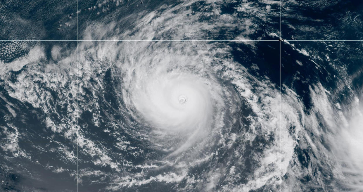
Meteorologists predict the hurricane winds will gradually weaken as Gilma moves in a west-northwest direction over the next several days.
Current location: Around 1,220 miles east of Hilo, Hawaii
Maximum sustained winds: 105 mph
Present movement: West at 8 mph
Where is Tropical Storm Hector now?
Tropical Storm Hector is gaining strength as it moves toward the southern tip of Mexico's Baja California peninsula. The hurricane center predicted that the tropical storm will have “some slight additional strengthening” in the next day or so.
Currentlocation: Around 1,080 miles west-southwest of the southern tip of Baja California
Maximum sustained winds: 50 mph
Present movement: West at 10 mph
Is Tropical Storm Hone still a threat to the Hawaiian Islands?
Tropical Storm Hone has passed south of Hawaii, away from the main Hawaiian Islands after wreaking havoc on part of the Big Island.
Current location: About 180 miles southwest of Honolulu, Hawaii, and about 185 miles south of Lihue, Hawaii
Maximum sustained winds: 70 mph
Present movement: West at 14 mph
As of Sunday night local time, Hone had dumped as much as 27.5 inches of rain in the town of Hakalau on Hawaii’s Big Island, with wind gusts peaking at 72 mph in the community of Kohala Ranch. Previous red flag warnings that strong winds could cause wildfires were called off due to the heavy rainfall.
Hawaii County Mayor Mitch Roth updated residents on a Facebook livestream that the Big Island is moving into the recovery stage, USA Today reported.
One day earlier, Hawaii Gov. Josh Green declared a state of emergency for the entire state of Hawaii, which would make state resources readily available to provide disaster relief to residents. It also allows him to activate the National Guard if needed.

