
Maps forecast 20C UK temperatures after 'shock to the system' Arctic air
Temperatures dropped as low as -2.7C overnight... but the weekend is set to be much warmer.
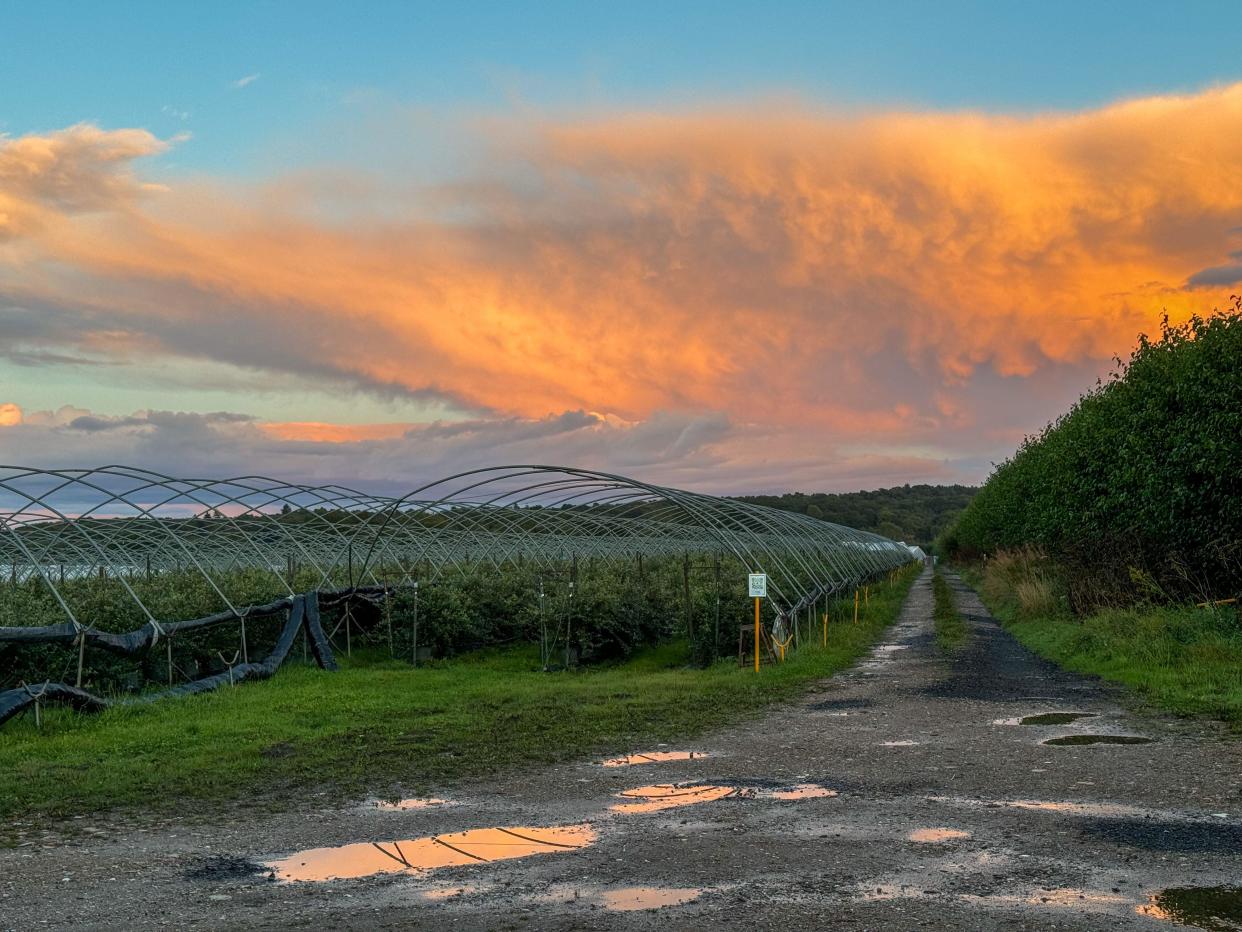
The -2.7C low in Topcliffe, north Yorkshire, came as widespread frost saw all four countries of the UK plunge below zero overnight.
The Met Office also said it is the earliest the south of Wales has seen frost in September since 2019.
But despite the chilly conditions over the past few days, the weekend is expected to be much warmer with many areas set to be “fine and dry” and temperatures reaching the high teens or even 20C.
Jason Kelly, chief meteorologist at the Met Office, said: “The cold Arctic air we have been experiencing will be replaced with warmer westerlies over the weekend."
And the warmer temperatures are expected to stay into next week, with the weather likely to be dry for many.
Read more: What will the weather be like this autumn? (Yahoo News UK)
Here, Yahoo News UK breaks down what the weather will be like for each region of the UK over the coming days, according to the Met Office's short-term forecasts.
London and the South East
Saturday
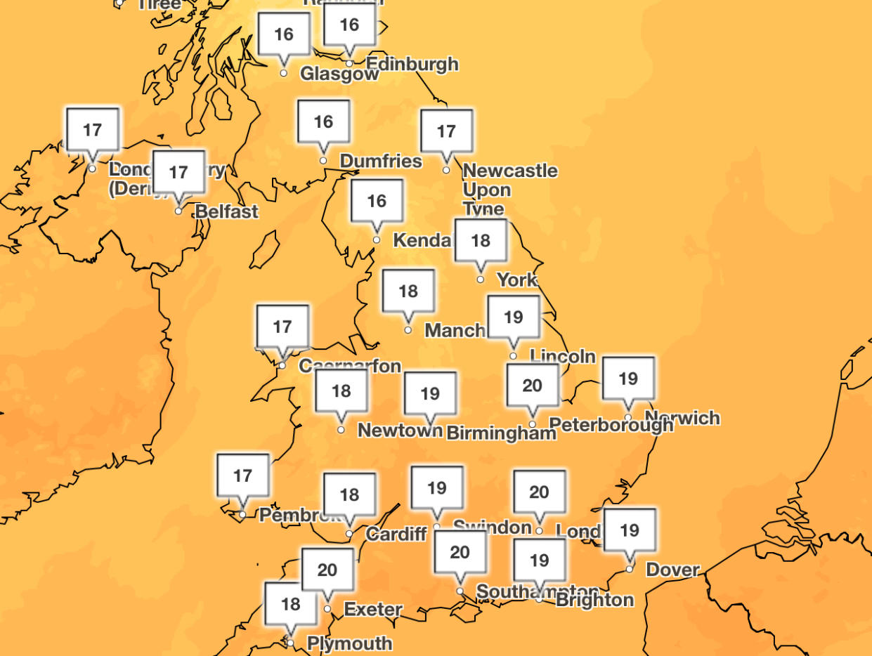
A fine and dry day with periods of sunshine, the sun becoming increasingly hazy. Warmer than Friday, feeling very pleasant. Maximum temperature 19C.
Sunday to Tuesday
Dry with plenty of hazy sunshine on Sunday. Rather cloudy on Monday and Tuesday but some mist and fog in any early break, some sunny spells in the afternoon.
South West
Saturday
As high pressure builds in the southern half of the UK, this brings plenty of fine and settled weather with sunny spells. Feeling warmer too with light winds. Maximum temperature 18C.
Sunday to Tuesday
High pressure means plenty of fine and settled weather continuing. Perhaps cloudier at times. Feeling warm, with the best of the sunshine along the south coast.
A cold arctic wind will be replaced with warmer westerlies over the weekend. Want to know more about the weather in the next 10 days?
Here's Annie with this week's 10 Day Trend 👇https://t.co/uesxmv8xYupic.twitter.com/1FnPXR1CSu— Met Office (@metoffice) September 11, 2024
Midlands
Saturday
East Midlands: A fine and dry day with periods of sunshine, the sun becoming increasingly hazy. Warmer than Friday, feeling very pleasant. Maximum temperature 19C.
West Midlands: As high pressure builds in the southern half of the UK, this brings plenty of fine and settled weather with sunny spells. Feeling warmer too with light winds. Maximum temperature 18C.
Sunday to Tuesday
East Midlands: Increasingly cloudy on Sunday, some rain in the northwest. Sunny with early mist and fog on Monday, cloudier later. Dry but rather cloudy on Tuesday, some sunny spells.
West Midlands: Largely dry and settled on Saturday with sunny spells. A chance of some rain and drizzle on Monday but largely dry again on Tuesday. Feeling pleasant in the sunshine.
North East
Saturday
Generally cloudy but bright and dry. Breezy over hills but less so elsewhere. Warmer than Friday, feeling very pleasant. Maximum temperature 18C.
Sunday to Tuesday
Wet in the west, the rain tentatively spreading east on Sunday. Sunny with early mist and fog on Monday, cloudier later. Rather cloudy on Tuesday, some drizzle in the west.

North West
Saturday
Another fine day with plenty of dry weather but perhaps more cloud around than of late. Winds strengthening with a fairly brisk breeze by the afternoon. Feeling a little warmer. Maximum temperature 18C.
Sunday to Tuesday
Patchy rain and drizzle, mostly affecting the north on Sunday before becoming heavier and more widespread on Monday. Drier and brighter by Tuesday. Warm in the sunshine. Breezy at times.
Scotland
Saturday
A mostly dry day with some brightness breaking through across the east and south. Outbreaks of rain will spread east later in the afternoon. Maximum temperature 18C.
Sunday to Tuesday
Dry with some sunshine on Sunday. Dry with bright spells early next week, becoming quite warm in any sunshine.
Northern Ireland
Saturday
Dry in the morning, some brightness in the southeast. The afternoon will be cloudy with some patchy rain spreading east. A warmer day. Maximum temperature 18C.
Sunday to Tuesday
Dry with some warm sunshine on Sunday. Staying dry on Monday. Dry, bright and warm on Tuesday.
Wales
Saturday
As high pressure builds in the southern half of the UK, this brings plenty of fine weather with sunny spells. Feeling warmer too. Turning rather breezy along northwestern coastlines. Maximum temperature 18C.
Sunday to Tuesday
Cloudy with some rain and drizzle on Sunday and Monday. Largely dry again on Tuesday. Feeling pleasant in the sunshine. Generally light winds but breezy at times around northwest coasts.

